Visual Workflows for Oil and Gas Exploration
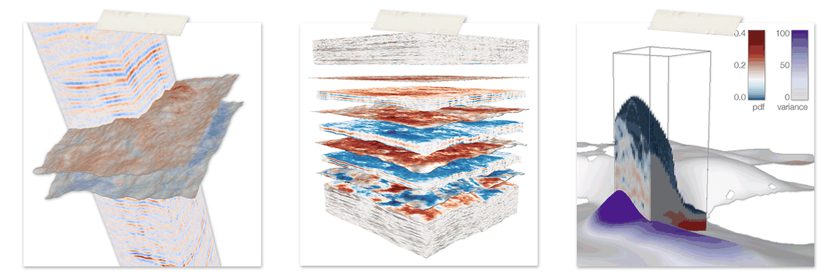
The most important resources to fulfill today's energy demands are fossil fuels, such as oil and natural gas. When exploiting hydrocarbon reservoirs, a detailed and credible model of the subsurface structures to plan the path of the borehole, is crucial in order to minimize economic and ecological risks. Before that, the placement, as well as the operations of oil rigs need to be planned carefully, as off-shore oil exploration is vulnerable to hazards caused by strong currents. The oil and gas industry therefore relies on accurate ocean forecasting systems for planning their operations. This thesis presents visual workflows for creating subsurface models as well as planning the placement and operations of off-shore structures. Creating a credible subsurface model poses two major challenges: First, the structures in highly ambiguous seismic data are interpreted in the time domain. Second, a velocity model has to be built from this interpretation to match the model to depth measurements from wells. If it is not possible to obtain a match at all positions, the interpretation has to be updated, going back to the first step. This results in a lengthy back and forth between the different steps, or in an unphysical velocity model in many cases. We present a novel, integrated approach to interactively creating subsurface models from reflection seismics, by integrating the interpretation of the seismic data using an interactive horizon extraction technique based on piecewise global optimization with velocity modeling. Computing and visualizing the effects of changes to the interpretation and velocity model on the depth-converted model, on the fly enables an integrated feedback loop that enables a completely new connection of the seismic data in time domain, and well data in depth domain. For planning the operations of off-shore structures we present a novel integrated visualization system that enables interactive visual analysis of ensemble simulations used in ocean forecasting, i.e, simulations of sea surface elevation. Changes in sea surface elevation are a good indicator for the movement of loop current eddies. Our visualization approach enables their interactive exploration and analysis. We enable analysis of the spatial domain, for planning the placement of structures, as well as detailed exploration of the temporal evolution at any chosen position, for the prediction of critical ocean states that require the shutdown of rig operations. We illustrate this using a real-world simulation of the Gulf of Mexico.
Resources
Citation
BibTeX
@phdthesis{ bib:2013_phd_thesis,
    author = {Thomas H{\"o}llt},
    title = { Visual Workflows for Oil and Gas Exploration },
    school = { King Abdullah University of Science and Technology },
    year = { 2013 },
}